The Euston Arch was, of course, the impressive Doric portico designed by Philip Hardwick which stood in front of the old Euston station before it was demolished by cunts in the 60s.
This was done in order to replace the original station, which was shit and made of sheds, with a new station, which was also shit, but made of concrete. It was kind of a rehearsal for replacing Birmingham New Street, which was also shit and made of sheds, with another station made of concrete but even more shit. They hadn't done anything like this before so they needed to practise to make sure they could make it shit enough.
Anyway there was a whole lot of bollocking on with John Betjeman and a
bunch of other people trying to stop the arch being demolished and
Harold Macmillan not being arsed to listen when they tried to tell him
about it, and shit. I'm not going to detail it here because there
is a fuck load of it and that's not what this page is about. There
isWAS a website "eustonarch dot org"
which goeswent into all the detail of the history and has lots of pictures
and things. Apparently when it was demolished they chucked most of it
into a river, and now the eustonarch dot org lot have found the bits and they
want to rebuild it, which ought to be a good idea except it would look
stupid now with all the crappy modern buildings behind it.
(NOTE: the eustonarch dot org domain has now (May 2023) been taken over by Indonesian spammers plugging bullshit "health" rip-off bollocks, so now it's nothing but a load of shite, and I don't know where, if anywhere, the real eustonarch people are or if they've had any luck.)
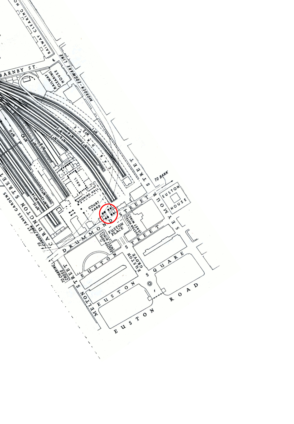
The point of this
page is that probably the most difficult thing to get your head round
when working out exactly what happened at Euston is where the fuck
everything was, because it was all different back then with streets
that don't exist any more and shit, and no fucker puts a decent map in
their articles on it. The eustonarch dot org website iswas better than most
in that it doesdid have before and after maps, but they
arewere not overlaid so it still isn'twasn't easy to match up the locations
between one and the other, and anyway the website is now inhabited by
irrelevant wankstains so it's no good at all any more.
So what I've done is I've downloaded the maps and made a Thing wot superimposes the one on the other and lets you turn the overlay on and off while you look and see what's underneath it. I didn't understand where shit all was before I made this, but now I do, and I'm putting it on this page so that you can too. The red circle is where the arch is. The one thing it doesn't do is show how far the platforms come down the modern Euston station, which is dead and chewed, but there isn't a map of that. As far as I can tell they can't end any further south than Drummond Street, but they probably don't end much further north either.
Hover your mouse over the image to turn the overlay on and off.
Drag the slider left and right to vary the opacity of the overlay.
Back to Pigeon's Nest
Be kind to pigeons